A powerful 7.4 Indonesia earthquake off the Molucca Sea on Thursday, April 2, 2026, has tragically claimed one life and generated a small tsunami, casting a harsh spotlight on regional disaster preparedness. The seismic event, initially reported with magnitudes as high as 7.8, underscores the persistent vulnerability of the Pacific “Ring of Fire” nations to geological forces that can reshape lives and landscapes in an instant.
The magnitude 7.4 undersea earthquake was centered at a depth of 35 kilometers (22 miles), approximately 127 kilometers west-northwest of Ternate, a significant urban hub in North Maluku province. While the deep ocean location likely mitigated some of the immediate surface impact, the shallow nature of the quake, combined with its proximity to populated areas, meant significant ground shaking was felt across the region.
Immediate Aftermath and Tsunami Activity
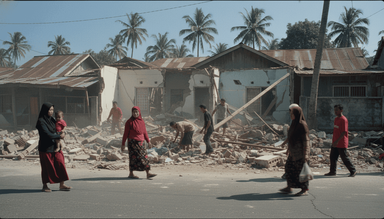
The human cost of the 7.4 Indonesia earthquake quickly became apparent. A 70-year-old woman in North Sulawesi’s Manado city tragically died due to a building collapse, and at least three other individuals were hospitalized in Ternate. Initial assessments from the rescue agency revealed light to severe damage to structures in parts of Ternate, including a church and two houses, with ongoing damage assessments in Bitung. Compelling videos released by the rescue agency depicted the extent of the destruction, showing damaged structures and flattened houses.
Adding to the immediate alarm, small tsunami waves were recorded at several monitoring stations roughly 30 minutes after the main tremor. Waves up to 75 centimeters (30 inches) above normal tides were observed in North Minahasa, 30 centimeters in West Halmahera, and 20 centimeters in Bitung. While Indonesia’s meteorological agency lifted its tsunami warning hours later, the Pacific Tsunami Warning Center in Honolulu noted that small waves were possible in Malaysia, the Philippines, Taiwan, and Papua New Guinea, though no threat to Hawaii or Guam materialized. Nearly 50 aftershocks rattled nearby areas, with one notably measuring 6.2 magnitude, further unsettling communities.
The Broader Context of Indonesia’s Seismic Vulnerability
Indonesia’s geographical placement on the Pacific “Ring of Fire” makes it inherently susceptible to frequent earthquakes and tsunamis. This geological hotspot, where several major tectonic plates converge, is a crucible of seismic and volcanic activity. Experts consistently highlight that while an earthquake’s magnitude is a critical factor, its depth, proximity to fault lines, and the quality of building construction are equally influential in determining the extent of damage. Shallow earthquakes, such as this 7.4 Indonesia earthquake, inherently pose a higher risk due to the amplified ground shaking they produce.
Disaster preparedness in Indonesia is a multifaceted endeavor, involving both governmental and non-governmental institutions. However, significant challenges persist, particularly in information management, coordination, and the limited knowledge and skills among various stakeholders. The Indonesian government has been striving to develop a robust national disaster management system since the catastrophic 2004 Aceh earthquake and tsunami, which resulted in an estimated 230,000 deaths and IDR 51.4 trillion (USD 3.5 billion) in economic losses.
“Radical changes in building standards and a focus beyond solely technological solutions are urgently needed to truly enhance disaster resilience in Indonesia,”
advocates Dr. Jonatan Lassa, a senior lecturer in Humanitarian, Emergency and Disaster Management at Charles Darwin University. There is a widely recognized imperative to strengthen disaster-resilient infrastructure and integrate disaster education into school curricula, tailored to local cultural contexts. Crucially, local community involvement and improved coordination between government and community organizations are deemed indispensable for effective disaster management strategies.
Economic Ripples and Future Preparedness
While comprehensive economic impact data for this specific 7.4 Indonesia earthquake is still being compiled, historical precedents offer a sobering glimpse into potential consequences. The 2018 Central Sulawesi earthquake and tsunami, a magnitude 7.5 event, inflicted an estimated US$911 million in economic losses and claimed 4,402 lives. Such events routinely damage vital infrastructure like roads and bridges, severely disrupting access to critical services and hampering recovery efforts. Indonesia currently allocates an estimated USD 300-500 million annually towards disaster recovery.
In a proactive move, the Indonesian Ministry of Finance has developed a disaster management risk financing strategy, which includes a Disaster Pooling Fund. This mechanism is designed to safeguard state finances and assets against the unpredictable and often devastating costs associated with major natural disasters. The ongoing need for such financial instruments, alongside continuous investment in early warning systems and community-level preparedness, remains paramount.
The recent 7.4 Indonesia earthquake serves as a stark reminder of the nation’s constant dance with geological forces. As recovery efforts commence, the focus will inevitably shift back to the long-term strategies for building greater resilience. The challenge for Indonesia lies not only in responding effectively to the immediate aftermath of such events but in fundamentally reshaping its infrastructure, educational systems, and community engagement to withstand the inevitable tremors of its dynamic geography. The global community will be watching closely as Indonesia continues to navigate this critical path towards enhanced disaster preparedness.